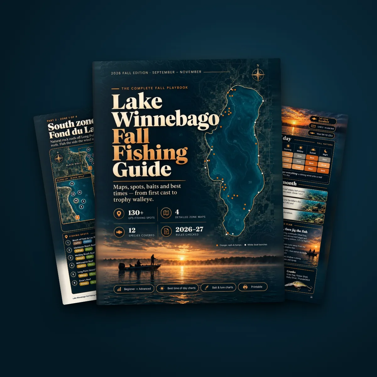
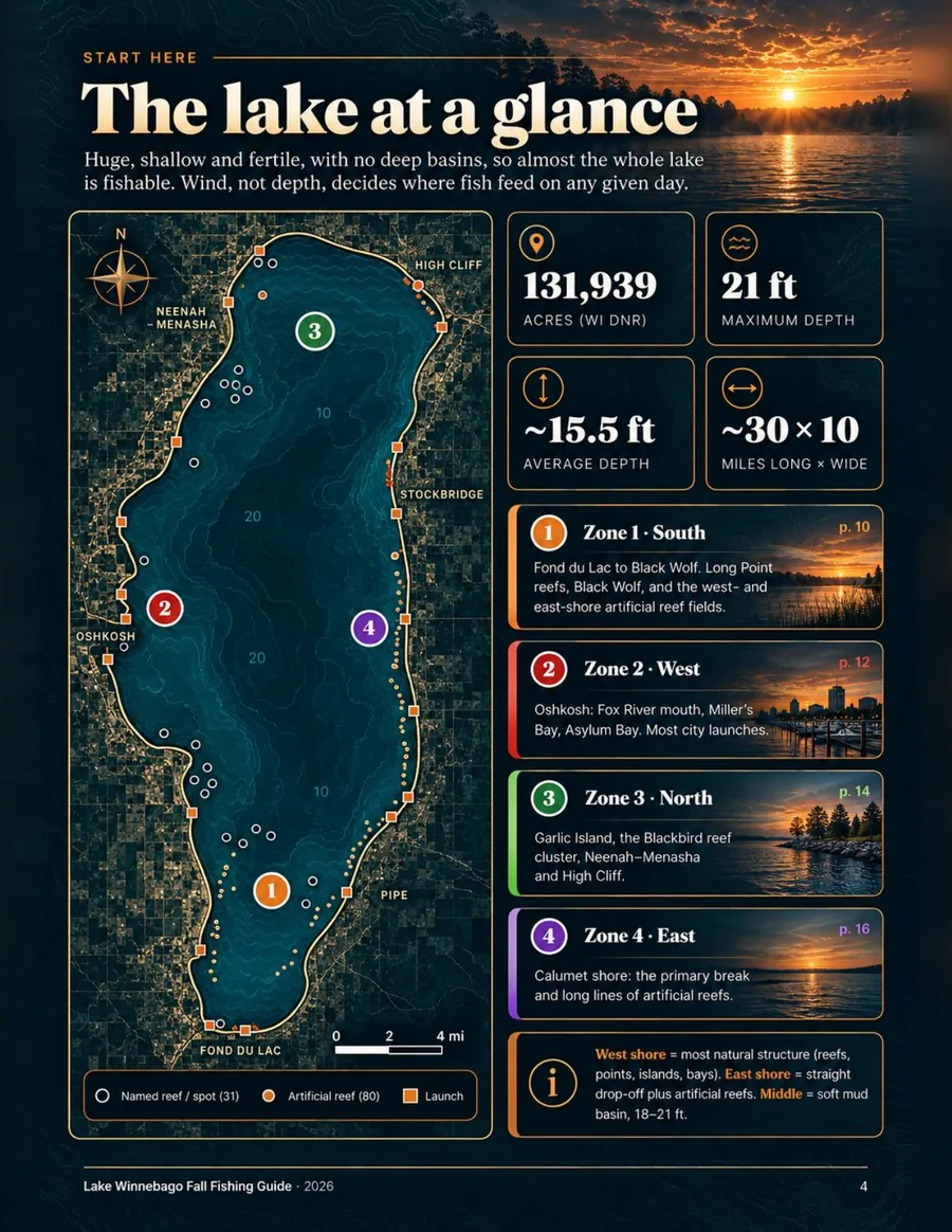
4 detailed zone maps
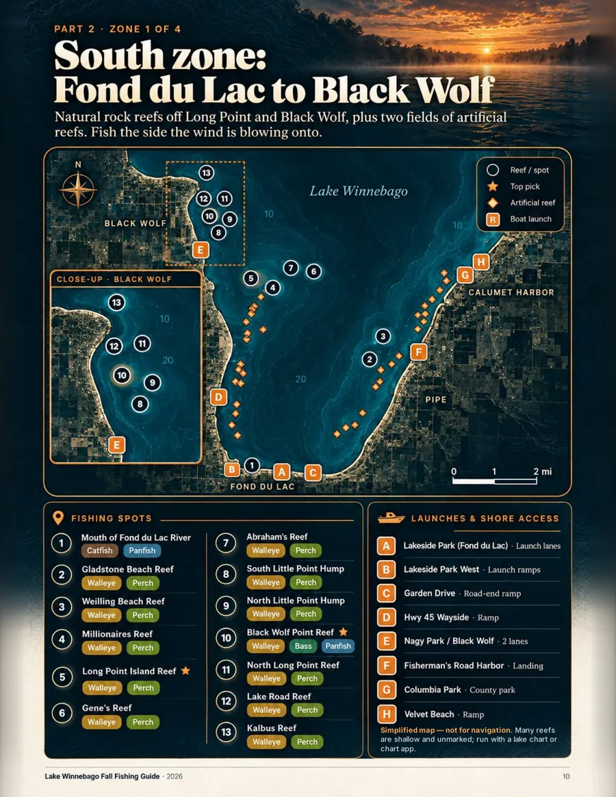
South, West, North and East with numbered spots, launches and close-ups.
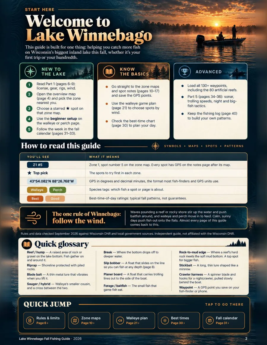
Use the wind to choose the right shore, open the matching zone map, load the GPS points, then follow the week-by-week plan for September through November.
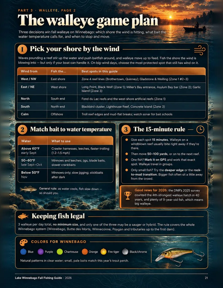
Start with the shore the wind is pushing into, not a random favorite spot.
Open South, West, North or East and choose spots that fit the day.
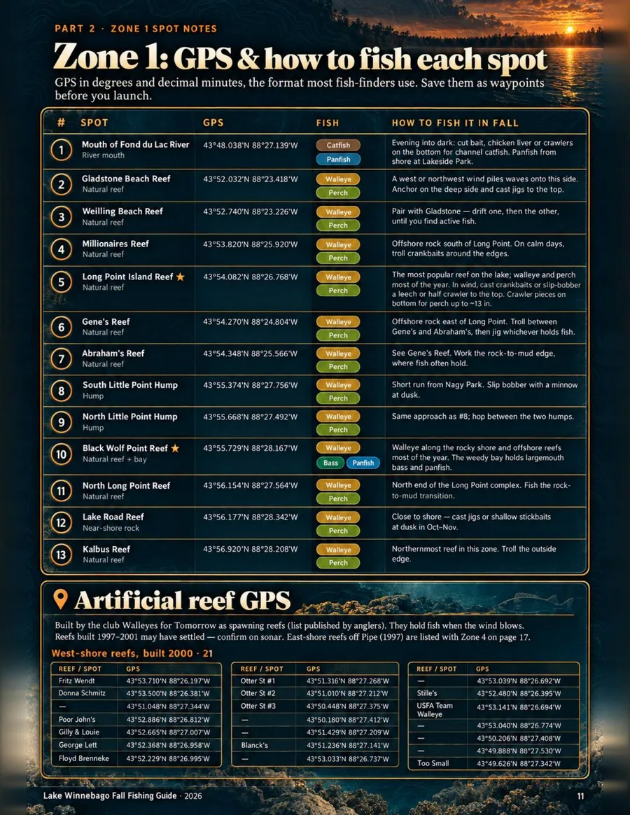
Use coordinates in the format most fish-finders use, then save them before launch.
September, October and November each have their own week-by-week pattern.
The guide is built to answer four practical questions: where to go, when to fish, what to use and when to move.
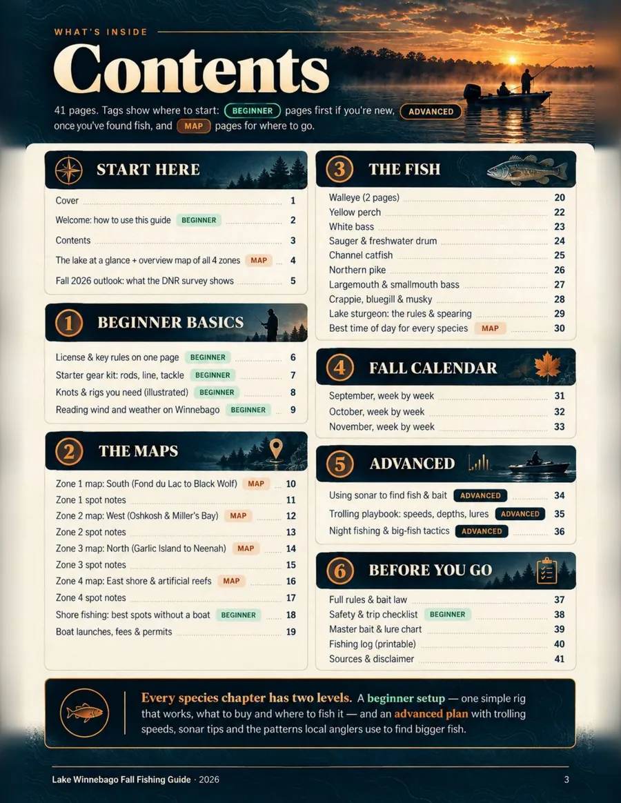
South, West, North and East with numbered spots, launches and close-ups.
Named reefs and humps, 80 artificial reefs, boat launches and shore spots.
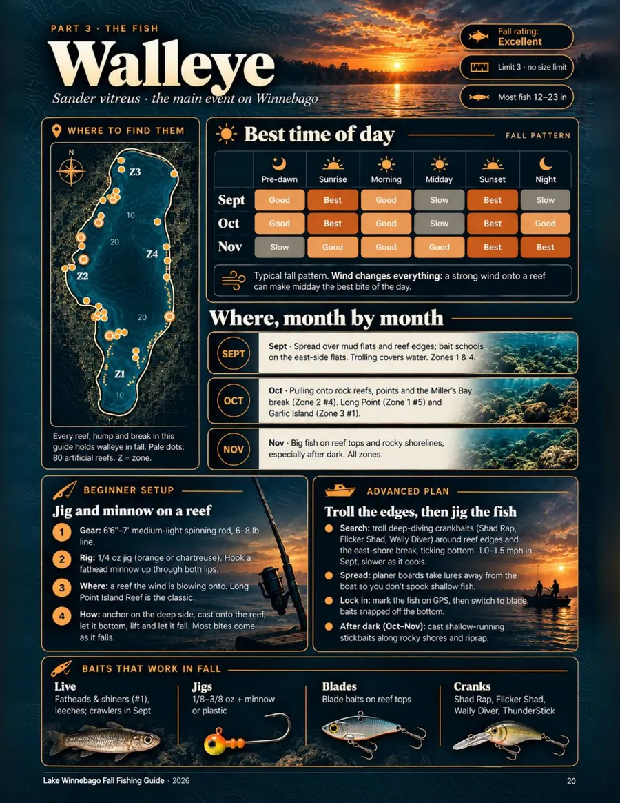
Monthly locations, best-time charts, baits, beginner setups and advanced plans.
Which shore to fish by wind direction, bait by water temperature and the 15-minute rule.
September, October and November broken down by changing conditions and fish behavior.
Sonar, trolling speeds and depths, night fishing and big-fish tactics.
Parks, piers, harbors and river mouths, plus shore tactics for anglers without a boat.
Boat access information plus the rules and bait-law pages to review before the trip.
Trip checklist, master bait and lure chart, fishing log and sources at the back.
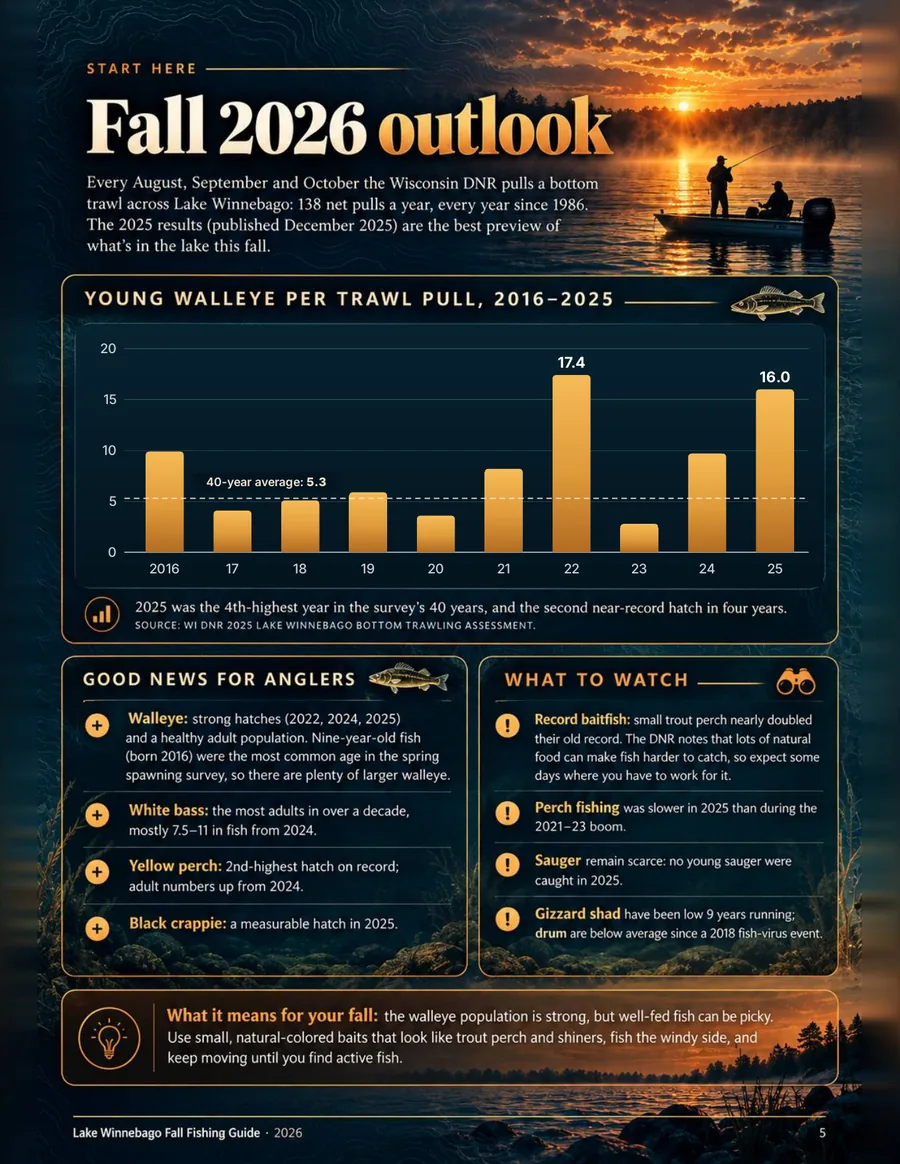
Wisconsin DNR 2025 trawl survey: 16.0 young walleye per trawl pull, the 4th-highest in the survey's 40 years.
130+ GPS points: including 80 artificial reefs plus natural reefs, humps, launches and shore spots.
Rules and prices checked September 2026 against Wisconsin DNR and local government sources.
Sources listed in the guide so you can see where the regulatory and fishing information came from.
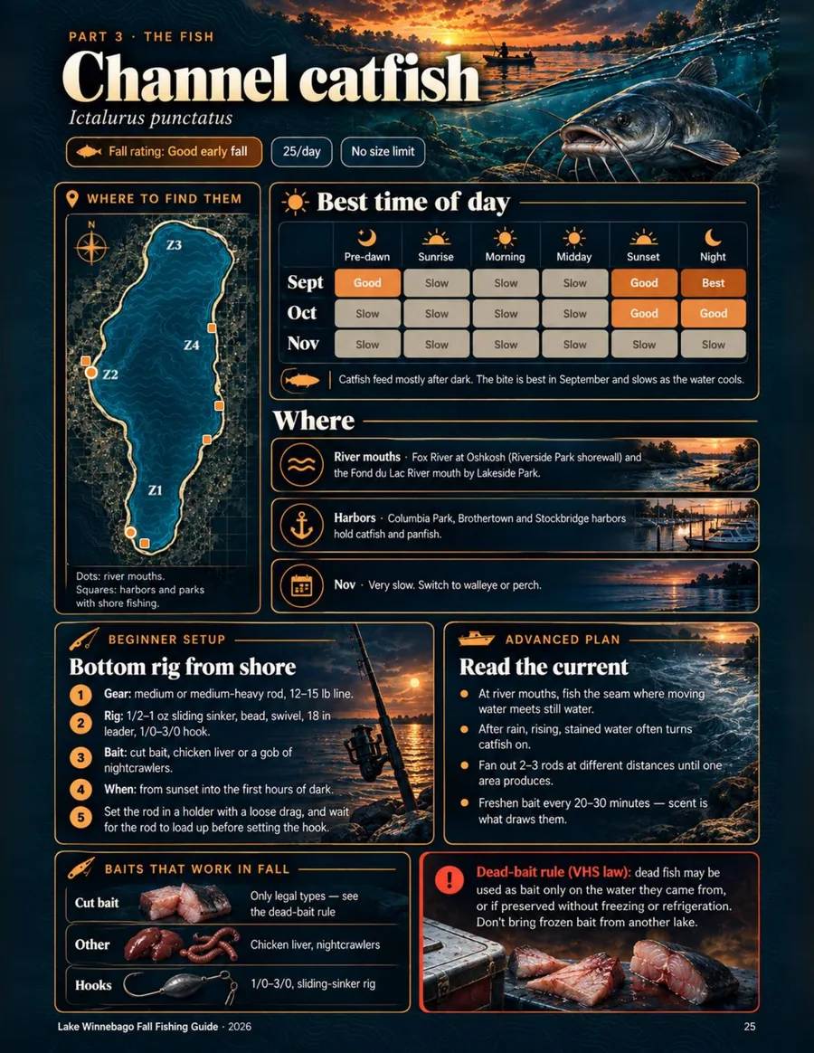
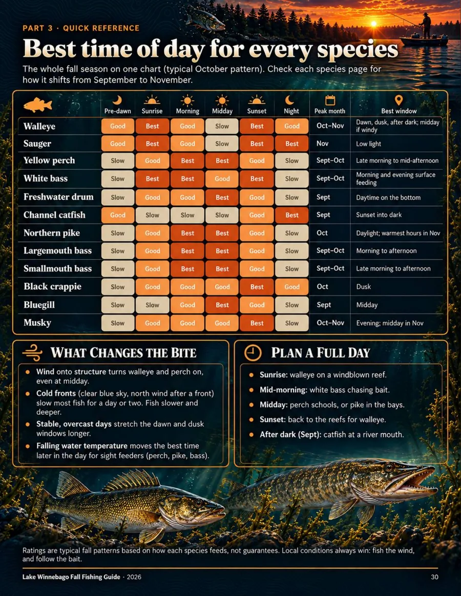
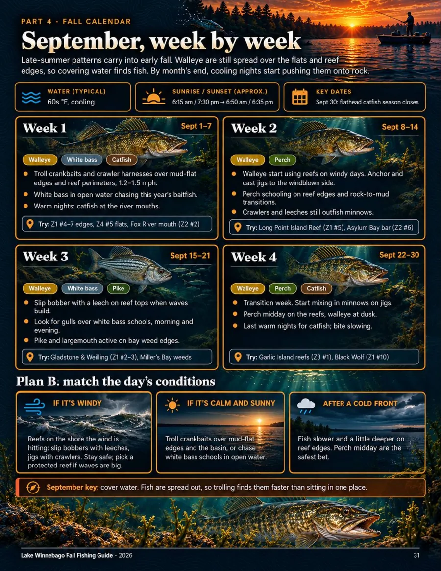
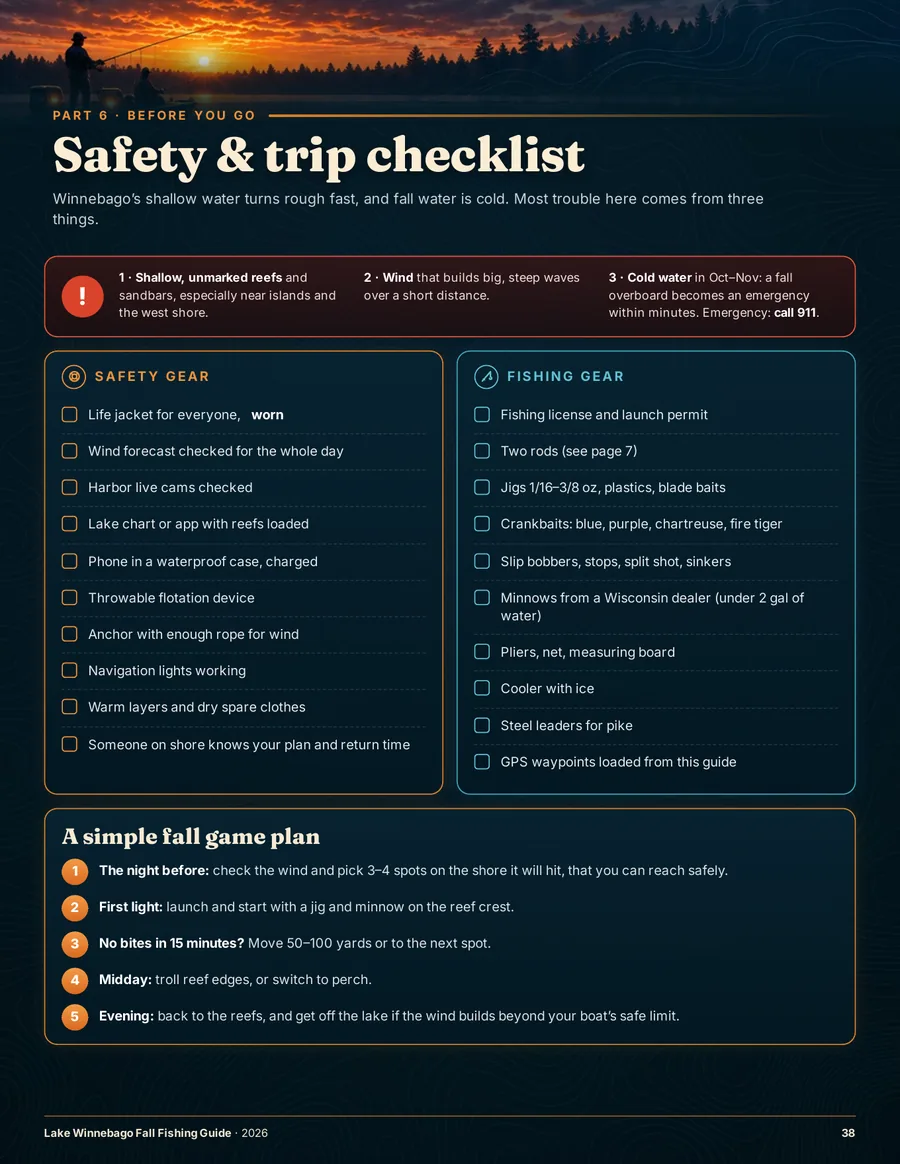
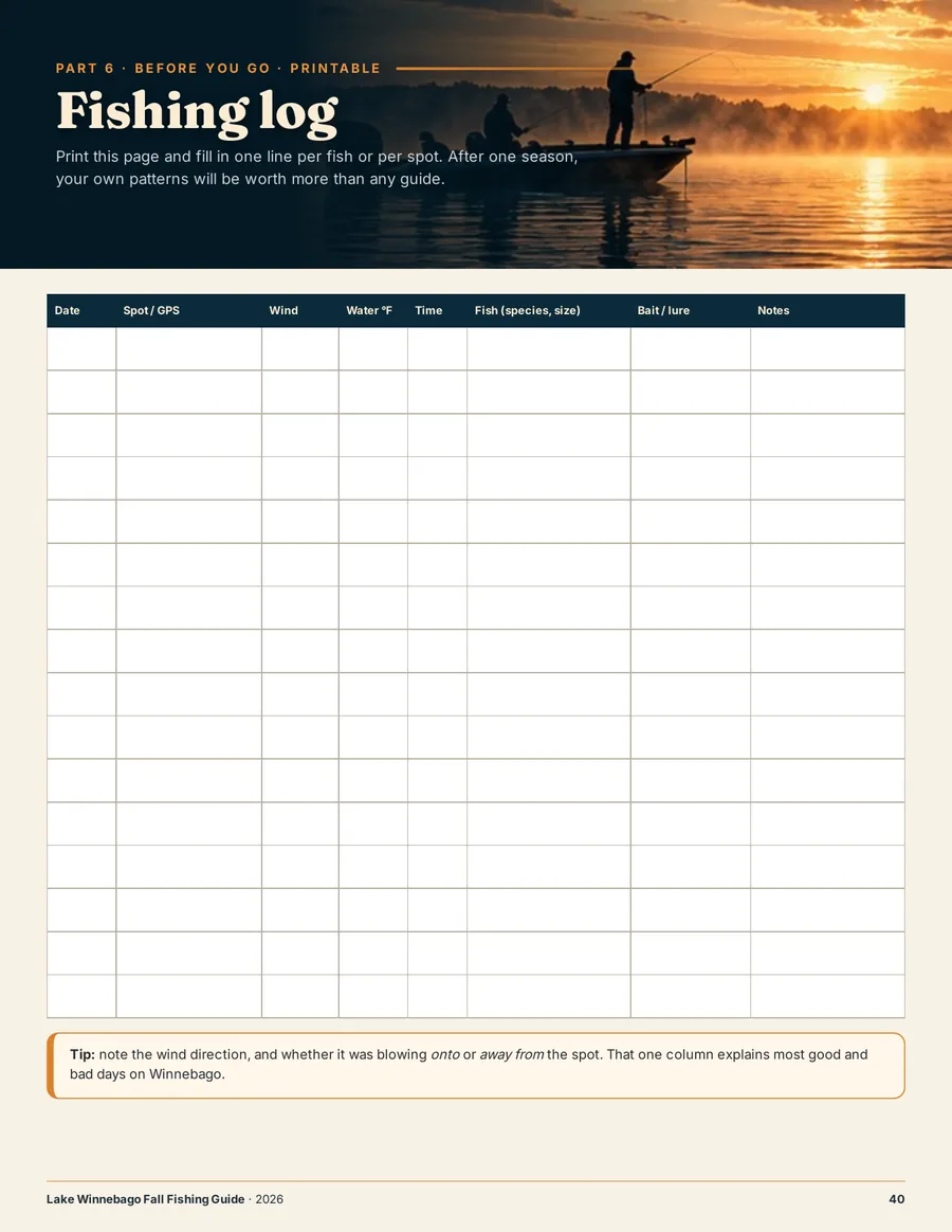
The guide includes parks, piers, harbors and river mouths, plus a full page of shore tactics. You do not need a boat to use the fall playbook.
Straight answers about the file, delivery, printing, rules and refunds.
A 41-page PDF: 4 zone maps, 130+ GPS points including 80 artificial reefs, 12 species, best times and baits, a week-by-week fall calendar, advanced tactics, 2026–27 rules, checklist and printable fishing log.
Right after payment you land on the download page, and Stripe emails your receipt. The download link works for 30 days, so save the PDF to your device.
Yes. The PDF has a clickable contents page and bookmark menu. Maps are sharpest zoomed in or printed.
Yes. The guide includes 17 public shore spots plus shore-fishing tactics.
Yes. It includes named reefs plus 80 artificial reefs with GPS, a wind game plan, trolling, sonar and night tactics.
They were checked against Wisconsin DNR sources in September 2026. Rules can change, so always confirm with the DNR before keeping fish.
No. It is an independent guide built from official sources and published angler knowledge. It is not affiliated with or endorsed by the Wisconsin DNR.
Yes. It is US Letter size, and the fishing log page is made to print and write on.
The guide is licensed for personal use. Please do not resell it or share the file publicly.
Try it for 14 days. If it's not right for you, email support@fishingbasecamp.com within 14 days of purchase for a full refund.
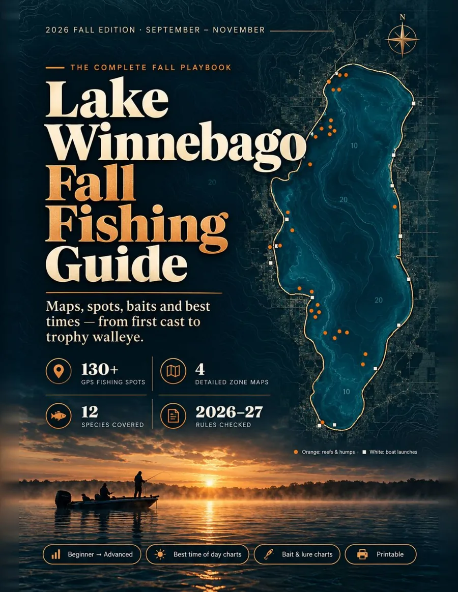
A 41-page US Letter PDF built around one simple system: check the wind, pick the zone, load the GPS points and follow the week's plan.
After payment, you land on the download page and Stripe emails your receipt. The download link works for 30 days, so save the PDF to your phone or computer. Personal-use license.